 Akamas is a magical place to explore on foot.
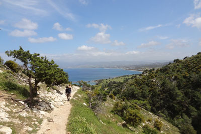
Without doubt, the best time to walk in the Akamas is March to June and September to November. The sun during this period lacks the energy sapping the intensity of summer and walking is a real pleasure.
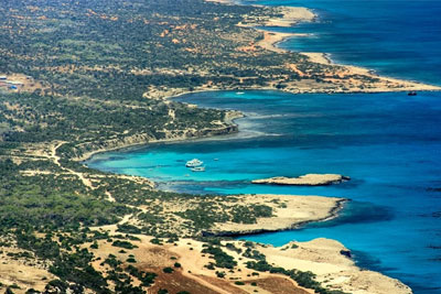
Within the Akamas you will find 7 circular well known nature trails including the Adonis and Aphrodite. The Avakas Gorge known as the 'diamond' of the area offers a more challenging experience.
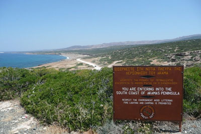
The easiest way to enter Akamas is from our village, Neo Chorio, on a good quality dirt road. There is also a coastal dirt road by Aphrodite’s Baths, where the views are extraordinary but the road is of poor quality if not on foot a 4x4 is essential.
Almost all paths have names deriving from mythology. This is not a coincidence since each path is associated with a legend of the area, giving to each path a touch of magic.
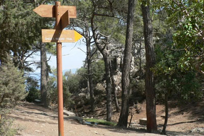
All paths are sign posted with way markers giving information on the various shrubs and trees which you are likely to see.
For all trails (apart from the Avakas) it is possible to set off from the Tavros Hotel Apartments on foot.
 Aphrodite’s Trail (circular) - One of the most beautiful routes one can visit in the area of Paphos.
Start Point: Baths of Aphrodite
End Point: Baths of Aphrodite
Estimated duration: 3-4 hours
Difficulty rate: Category 3: High degree of difficulty. Route with difficult terrain such as sudden changes in gradient (uphill and/or downhill), course along particularly rough and/or slippery, and/or narrow, and/or steep terrain. Suitable for adults in very good to excellent fitness levels. Unsuitable for young children.
Trip Length: 7.5 kilometers
Points of interest
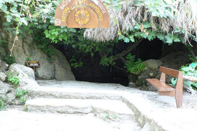
The baths of Aphrodite where, according to tradition, the Goddess of Love used to bathe. It is here where the famous goddess met Adonis, who fell in love with her beauty after he went to the baths to drink water.
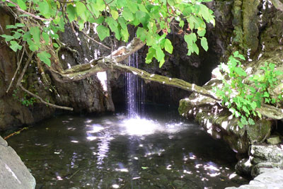
Ruins of the Pyrgos tis Rigainas (Queen’s Tower), which are believed to have belonged to a medieval monastery. It is worth mentioning the huge centuries-old oak tree which can be seen at the picnic site, where drinking water is also available. Along the trail there are several points which give a view of Polis Chrysochous and the Paphos Forest. Along the route, there are two potable water fountains, one near the ruins of Pyrgos tis Rigainas (Queen’s Tower) and one between location Loutra and Kakoskali. The trail links with Adonis trail.
The section between the Baths and Pyrgos tis Rigainas (the Castle of Regina – Queen’s Tower) is shared with the Adonis trail. The trail follows a rising path to the hill known as Moutti tis Sotiras (370m) and this can be quite tiring, especially in summer. There are springs with drinking water at two points, one at Pyrgos tis Rigainas (the Castle of Regina) and the other at Kefalovrisia.
 Adonis Nature Trail (circular)
This trail offers views to Polis, Paphos Forest (Paphos Forest) and the Akamas peninsula. The path goes past Pyrgos tis Rigainas (Queen’s Tower), linking up with the Smigies trail at Kefalovrysia, where there is a fountain with drinking water. There is an alternative possibility of linking up with the Aphrodite trail. To return full circle, the trail follows the main road that connects Baths of Aphrodite with Polis for about 400 meters.
Start Point: 400 meters before Baths of Aphrodite
End Point: Baths of Aphrodite
Estimated Duration: 3 - 4 hours
Difficulty Rate: Category 3: High degree of difficulty. Route with difficult terrain such as sudden changes in gradient (uphill and/or downhill), course along particularly rough and/or slippery, and/or narrow, and/or steep terrain. Suitable for adults in very good to excellent fitness levels. Unsuitable for young children.
Trip Length: 7.5 kilometers
 Smiyies Trail - A unique nature trail situated in the area of Akamas forest. This path is divided in two parts: the short and the long path. In all cases, the routes are amazing, with the walker having direct contact with the nature.
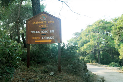
Smigies Short Route (Circular) Nature Trail
Start Point: Smigies picnic site, 2.5 kilometers west from Neo Chorio village, in the Akamas region.
End Point: Smigies picnic site
Estimated Duration: 1 hour
Difficulty Rate: Category 2: Average degree of difficulty, suitable for adults in fair to good fitness levels. Sudden changes in gradient (uphill and/or downhill), and/or course along narrow or rough terrain.
Trip Length: 2.5 kilometers
Smigies Long Route (Circular) Nature Trail
Start Point: Smigies picnic site, 2.5 kilometers west from Neo Chorio village, in the Akamas region.
End Point: Smigies picnic site
Estimated Duration: 2 hours
Difficulty Rate: Category 2: Average degree of difficulty, suitable for adults in fair to good fitness levels. Sudden changes in gradient (uphill and/or downhill), and/or course along narrow or rough terrain.
Trip Length: 5 kilometers
Points of interest
View to the east of Polis Chrysochous Bay, Latchi, Pachyammos and Paphos Forest, and to the west Lara Bay, Tzioni, Karavopetres, etc. The long route goes past the disused magnesium mines which include a deserted kiln and then through a dense part of Akamas forest. The long route links up with Adonis trail at the location Kefalovrysia (potable water fountain location). At their starting point both trails pass by Piana fire lookout station.
 Pissouromoutti (Circular) Nature Trail
Start Point: Smigies picnic site, 2.5 kilometers west from Neo Chorio village, in the Akamas region.
End Point: Smigies picnic site
Estimated Duration: 1.5 hours
Difficulty Rate: Category 2: Average degree of difficulty, suitable for adults in fair to good fitness levels. Sudden changes in gradient (uphill and/or downhill), and/or course along narrow or rough terrain.
Trip Length: 3 kilometers
Points of interest
Rich in forest vegetation such as Phoenician juniper, the trail offers views towards Chrysochou Bay to the northeast and Akamas coastline to the west. There are panoramic views from the peak.
 Akamas Adventure
A long trail with rough hills and steep, dark valleys with sparse scrub stretch from one coast line to the other, meeting at the center, creating Cape Arnaoutis, an important lookout point for centuries. From the lighthouse to the coast through scraggy trees, to arrive at Fontana Amaroza bay, clear blue waters ideal for swimming.
Start Point: Is the start point of the Adonis trail
End Point: Baths of Aphrodite
Estimated Duration: 5-6 hours
Difficulty Rate: Category 3: High degree of difficulty as it’s a long hike. Route with difficult terrain such as sudden changes in gradient (uphill and/or downhill), course along particularly rough and/or slippery, and/or narrow, and/or steep terrain. Suitable for adults in very good to excellent fitness levels. Unsuitable for young children.
Trip Length: 22 kilometers
 Neo Chorio to Androlikou
Start Point: Smigies picnic site, 2.5 kilometers west from Neo Chorio village, in the Akamas region
End Point: Neo Chorio
Estimated Duration: 5-6 hours (shorter walk 4-5 hours)
Difficulty Rate: Category 2-3: Fair to high degree of difficulty, suitable for adults in good fitness levels. A long walk rather than a difficult terrain. Wide tracks
So be aware of cars going by.
Trip Length: 22 kilometers (shorter walk 15 km)
Points of interest
A long pleasantly broad trail through silent woodland and goat farms. Androlikou village, a Turkish village which has been deserted for the last 40 years.
 Avakas Gorge – apprx. 30 minutes drive from the Tavros
Start Point: From the Viklari Taverna, turn right uphill, then descend to the car park below,
End Point: Car park
Estimated Duration: 4-5 hours
Difficulty Rate: Category 4-5: High degree of difficulty, suitable for regular adult walkers. At times strenuous requiring walkers to climb over large slippery boulders.
Trip Length: 7 kilometers
To get to Avagas, drive towards Droushia along the road E709, head for Ineia and Pano Arodes then follow the signs for Avagas gorge.
A trekker’s paradise, it offers spectacular views and a generous introduction to local flora and fauna. Carved out of limestone rocks, rising up as high as 30 meters and narrowing dramatically at one point, the gorge is a difficult hike as the rough track winds its way along and over the stream that formed this natural wonder over thousands of years. Parts of the walk are slippery and involve a certain amount of clambering over rocks and stones. Solid footwear and sensible clothes are recommended. Visitors are advised to take ample drinking water and urged not to enter the gorge alone without first informing someone of their plans, mobile phones do not work in the gorge and there are no shortcuts. If at any time you decide you had enough just turn back.
Rich in flora, the gorge has pine trees, cypresses, junipers, wild fig trees, ferns and oaks among other trees as well as a profusion of wild flowers. Prize specimen among them is the extremely rare endemic centauria akamandis with its purple flowers that blossoms in the spring. Animal life includes foxes, hares, falcons, crows, night owls, butterflies and a large number of reptiles.